On this page
The core N1 geography words here are 河川(かせん), 崖(がけ), 山脈(さんみゃく), 地形(ちけい) and 浜(はま). They move beyond naming a place and let you describe a landscape as a system: waterways shape terrain, mountain ranges direct flow, and cliffs or shores mark sharp boundaries.
Five words, one geographic system
All five are nouns. The collocations show the register each word naturally enters.
| Word | Reading | Core sense | Useful collocation |
|---|---|---|---|
| 河川 | かせん | river; rivers as waterways | 河川が氾濫する, a river floods |
| 崖 | がけ | cliff; steep face | 崖が崩れる, a cliff collapses |
| 山脈 | さんみゃく | mountain range | 山脈が連なる, a mountain range extends |
| 地形 | ちけい | terrain; topography; landform | 複雑な地形, complex terrain |
| 浜 | はま | shore; flat land beside sea or lake | 浜を歩く, walk along the shore |
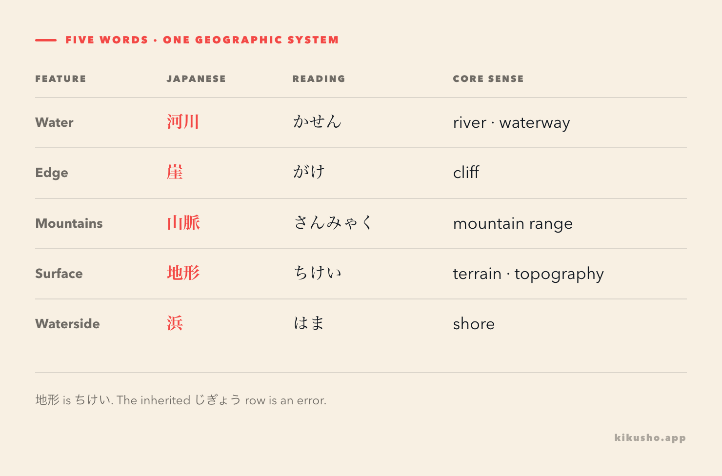
There is a source error to remove before memorising anything: 地形 is read ちけい. One inherited curriculum row pairs 地形 with じぎょう, but that is not an alternative reading. Kanjipedia's 地形 entry gives ちけい and defines it as the form of the earth's surface, such as mountains, rivers and plains. The erroneous row is retained in the audit trail and corrected here rather than taught.
The reference lists used for this curriculum place these records at N1, and independent N1 lists also include several of the same headwords. Since the test makers provide no exhaustive word list, the level is a study estimate. The spelling, reading and meaning still need dictionary and real-use verification regardless of level.
河川 is the geographic and administrative river
川(かわ) is the ordinary noun for a river. 河川 treats flowing water as a geographic category, water system or managed public feature. It is common in maps, environmental reports, disaster information and public works.
この地域では、複数の河川が山脈から海へ流れている。 この ちいきでは、ふくすうの かせんが さんみゃくから うみへ ながれている。 In this region, several rivers flow from the mountain range to the sea.
大雨により河川が氾濫するおそれがある。 おおあめにより かせんが はんらんする おそれが ある。 Heavy rain may cause rivers to flood.
Kotobank defines 河川 as flowing water that follows a broadly fixed channel and empties into a lake, sea or another river. The term can refer to one river in an official category, as in 一級河川, so it does not mechanically mean a grammatical plural.
The Geospatial Information Authority of Japan repeatedly combines 河川, 地形 and compounds with 崖 when describing river terraces and erosion. That is the register to notice: these nouns explain how the land is formed, classified or managed.
山脈 is a form; 地形 is the whole surface
山脈 is a long connected chain of mountain ridges. Kotobank's geographic definition describes principal ridges continuing in a long, vein-like line. The word is more specific than a general mountain area, and established proper names decide whether Japanese uses 山脈, 山地 or another term.
山脈を越える道路が冬の間、閉鎖される。 さんみゃくを こえる どうろが ふゆの あいだ、へいさされる。 The road crossing the mountain range is closed during winter.
地形 is the larger category: the shape and features of the ground. A mountain range is one kind of 地形, as are a valley, plain, river terrace and coastal cliff. It also appears in descriptions of what terrain permits or prevents.
この地形を利用して、集落が風から守られている。 この ちけいを りようして、しゅうらくが かぜから まもられている。 The settlement is protected from the wind by making use of this terrain.
地形が複雑なため、直線の道路を造るのは難しい。 ちけいが ふくざつな ため、ちょくせんの どうろを つくるのは むずかしい。 Because the terrain is complex, building a straight road is difficult.
The distinction matters in reading. 山脈が地形を形成する does not repeat the same noun twice: a mountain range contributes to the terrain of a region.
崖 and 浜 draw opposite edges
崖 names a steep or nearly vertical face on a mountain, riverbank or coast. Kotobank records がけ for a sharply rising or falling part of a mountain or shore.
浜 points to relatively flat land along the water's edge. Kotobank's 浜 entry includes the edge of a sea or lake, so 浜 is not limited to ocean beaches. Nor does the bare word guarantee sand: 砂浜(すなはま) states that the shore is sandy.
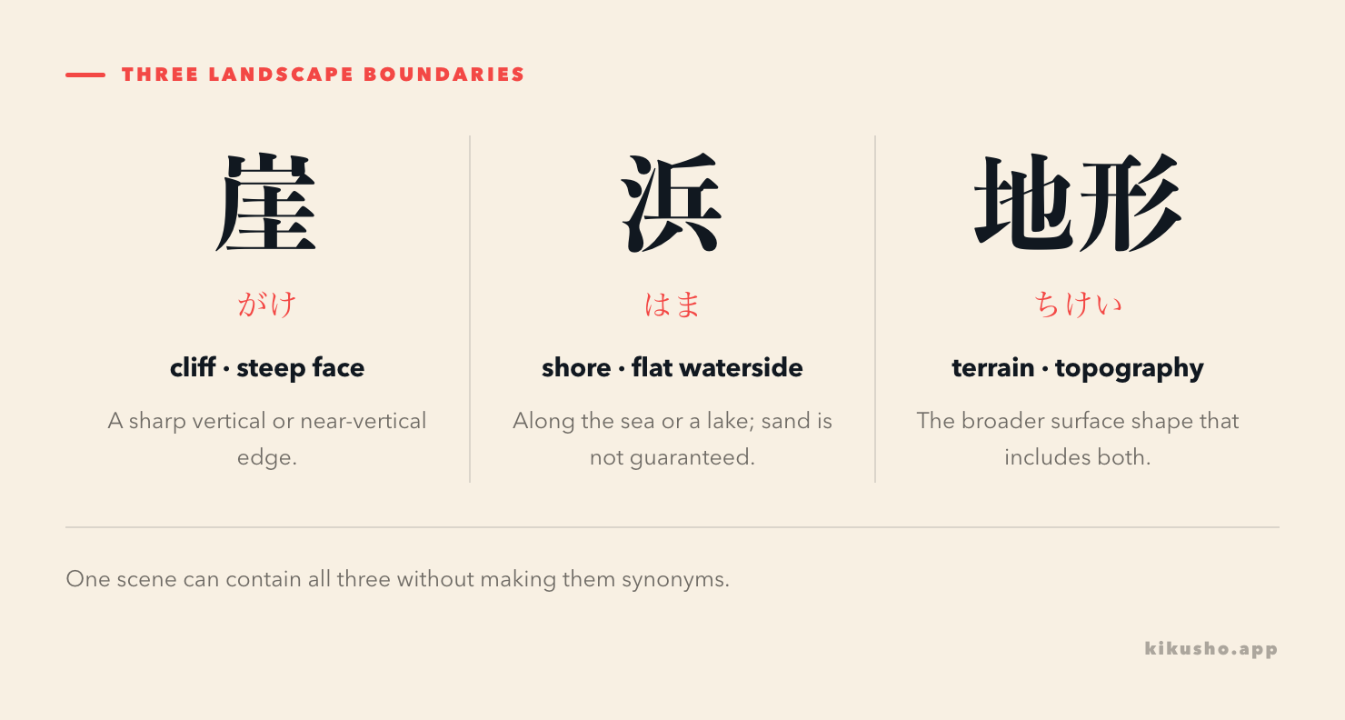
崖の下に細い浜が続いている。 がけの したに ほそい はまが つづいている。 A narrow shore continues below the cliff.
波で崖が削られ、浜の形も変化した。 なみで がけが けずられ、はまの かたちも へんかした。 The waves eroded the cliff, and the shape of the shore also changed.
The N4 landscape lesson distinguishes 海岸 from a sandy beach. At N1, 浜 adds a closer view of the waterside ground, while 崖 supplies the steep face that can stand immediately behind it.
Read the terrain as a chain of causes
The five nouns become easier when one sentence makes the relationships visible.
この山脈は複雑な地形をつくり、そこを流れる河川は深い谷を刻んでいる。河口の近くでは、崖の下に浜が広がるが、大雨の後は崖が崩れる危険がある。
この さんみゃくは ふくざつな ちけいを つくり、そこを ながれる かせんは ふかい たにを きざんでいる。かこうの ちかくでは、がけの したに はまが ひろがるが、おおあめの あとは がけが くずれる きけんが ある。
This mountain range creates complex terrain, and the rivers flowing through it carve deep valleys. Near the river mouth, a shore spreads below the cliff, but after heavy rain there is a danger of the cliff collapsing.
The passage presents 山脈 as a specific connected feature and 地形 as the resulting surface. 河川 suits the explanatory register, while 崖 and 浜 identify contrasting edges. The words now form a causal description instead of five English labels.
When you capture geography from an article or warning in Kikusho, keep the predicate with the noun: 河川が氾濫する, 崖が崩れる, 浜が広がる. For 地形, preserve the adjective or verb that says why the terrain matters. This gives the review card enough context to recover the register as well as the definition.
Practice reading the landscape
Question 1 · correct reading
Which reading belongs to 地形?
- A. じけい
- B. じぎょう
- C. ちけい
- D. ちぎょう
Question 2 · mountain range in context
Which sentence uses 山脈(さんみゃく) naturally?
- A. 山脈が南北に連なっている。
- B. 山脈を一杯飲んだ。
- C. 山脈を三人招待した。
- D. 山脈が新聞を読んだ。
Question 3 · register
A government report discusses waterways and flood control across a prefecture. Which noun best fits the rivers as managed geographic features?
- A. 浜
- B. 河川
- C. 崖
- D. 山脈
Question 4 · landform scope
Select the natural sentence with 地形.
- A. 地形を一冊読みました。
- B. 地形を一杯飲みました。
- C. 地形が複雑で、道路を造りにくい。
- D. 地形を三人招待しました。
Question 5 · shore or cliff
Fill the two blanks in order: 急な( )の下に、細い( )が続いている。
- A. 浜 / 山脈
- B. 河川 / 地形
- C. 地形 / 崖
- D. 崖 / 浜
Question 6 · explain the sentence
What does 河川が山脈から海へ流れている say?
- A. Cliffs are moving toward the mountains.
- B. Rivers flow from the mountain range to the sea.
- C. A sandy beach covers the terrain.
- D. A road crosses a river.
Question 7 · correction check
Which statement follows the reviewed evidence?
- A. 地形 has two standard readings, ちけい and じぎょう.
- B. じぎょう is the preferred geography reading of 地形.
- C. 地形 is read ちけい; the じぎょう source row is erroneous.
- D. 地形 can only describe mountains.
Question 8 · connected passage
Read: 河川が深い谷を刻み、河口の近くでは崖の下に浜が広がっている。 Which description matches?
- A. A river has carved a deep valley, and a shore spreads below a cliff near its mouth.
- B. A mountain range has disappeared under a lake.
- C. A cliff has blocked every river in the region.
- D. Flat terrain extends above the mountains.
Answers and explanations
Solution 1
Choose C, ちけい. Kanjipedia and ordinary geographic use confirm this reading. じぎょう is not an alternate reading of 地形.
Solution 2
Choose A. 山脈が南北に連なっている means that a mountain range extends north to south. Drinking, inviting or reading cannot naturally take a mountain range as the participant described here.
Solution 3
Choose B, 河川. The technical and administrative setting favors 河川 for rivers or waterways as geographic and managed features. The other choices mean shore, cliff and mountain range.
Solution 4
Choose C. Complex terrain can make road construction difficult. The other sentences assign reading, drinking or inviting to a landform noun and are semantically unsuitable.
Solution 5
Choose D, 崖 / 浜. A steep cliff can rise above a narrow shore. Reversing them or inserting 河川, 地形 or 山脈 destroys the physical relationship described.
Solution 6
Choose B. 河川 names the rivers, 山脈 is their point of origin, and 海 is their destination. No road, cliff movement or sandy surface is stated.
Solution 7
Choose C. The word is 地形(ちけい). The inherited じぎょう row conflicts with dictionaries and actual geographic usage, so the lesson corrects it instead of presenting a false variant.
Solution 8
Choose A. 河川 is the river, 谷 is the valley it carves, 河口 locates the river mouth, 崖 is the cliff, and 浜 is the shore below it.
Common questions
How do you read 河川, 崖, 山脈, 地形 and 浜?
The readings are 河川(かせん), 崖(がけ), 山脈(さんみゃく), 地形(ちけい)and 浜(はま). 地形 is never read じぎょう; that reading in one inherited source row is an error.
What is the difference between 川 and 河川?
川 is the ordinary word for a river. 河川 is a collective or technical term common in geography, environmental reporting, public works and regulation. It may refer to one river as a managed waterway or to rivers as a class.
What is the difference between 浜 and 海岸?
浜 is a flat waterside area along the sea or a lake, while 海岸 names the broader coastal zone where land meets the sea. Neither word guarantees sand; 砂浜 is explicitly a sandy beach.
Is 山脈 the same as 地形?
No. 山脈 is a mountain range, one particular connected landform. 地形 is the broader idea of terrain or topography and can describe mountains, valleys, plains, river terraces and coastal features.